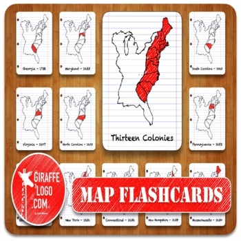
13 Colonies Geography Flashcards with both Printable & Digital Maps
- Zip
Also included in
- ENTIRE WORLD Map Flashcard Set Includes x900 Flashcards of ALL 270 Total Countries + Locations in both Printable & Digital formats. Flashcards are easy to use & perfect for a quick print & go or for creating fun interactive resources like geography games, activities, quizzes, presentatioPrice $20.00Original Price $34.00Save $14.00
Description
THIRTEEN COLONIES Map Flashcard Set Includes x45 Flashcards of ALL 13 Colonies plus in both Printable & Digital formats. Flashcards are easy to use & perfect for a quick print & go or for creating fun interactive resources like geography games, activities, quizzes, presentations, worksheets, & more!
✅ What Is Included?
1) Zip File = Packed full of 45 Flashcards for ALL 13 US Colonies.
—> Simple to Use, Easy to Download, Engagingly Themed, 3-Part Flashcards.
2) Printable Flashcards = PDF Document complete with x3 Flashcards Per Page.
—> Just Print the PDF document, cut out the flashcards, laminate if you wish, & enjoy!
3) Digital Flashcards = Folder filled with Resizable, High Definition, PNG Flashcards for every Colony.
—> Quickly spice up any Presentation, Worksheet, Quiz, Activity, or Poster by adding Map Graphics.
✅ 17 Three-Part Flashcards with Hand Drawn Themes
—> Each Flashcard comes in x3 different styles / variations including…
Full Label + Map Card - Includes each Colonies Full Name as well as a Highlighted Map
Highlighted Map Only Card - Includes only the highlighted Map of each Colony (no label)
Labeled Name Only Card - Includes only the name / label of each Colony (no map)
✅ MAP PACK ALSO INCLUDES…
Commercial License for TPT Sellers - Includes a commercial license for TPT sellers to utilize graphics in their store (please review the terms of use page included for guidelines).
Graphics + Clipart - Includes tons of High Definition, stand-alone Graphics & Clipart for each map in both PDF & PNG formats so you can easily drag & drop anything, anywhere.
✅ Includes 17 Maps & Locations surrounding the Thirteen Colonies!
+ Thirteen Colonies Full Map
+ Thirteen Colonies Blank Map
1) Virginia (1607)
2) New York (1626)
3) Massachusetts (1630)
4) Maryland (1633)
5) Rhode Island (1636)
6) Connecticut (1636)
7) New Hampshire (1638)
8) Delaware (1638)
9) North Carolina (1653)
10) South Carolina (1663)
11) New Jersey (1664)
12) Pennsylvania (1682)
13) Georgia (1732)
14) Indian Reservation
15) Spain
We want to hear from you! - Since we are relatively new, we are dying to hear from you! Whether you have a question as to how to edit a particular map, a suggestion for ways to improve, a request for what you would like to see in the future, or even a simple “here is how I used it” story, we are only an email away & we are here to help! Contact Us @ giraffelogo.comor Email Us @giraffelogo.com@gmail.com


