6 results
Geography handouts for Easel Assessments
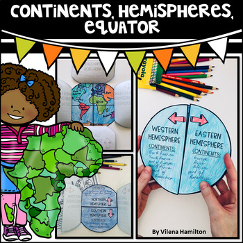
Continents. Hemispheres. Equator. Reading Passage & Foldable.
Reading Passage + Foldable to help your students memorize the continents and understand hemispheres in a simple and not so boring way. Here is what's included:- 2-Page Reading Passage about continents, hemispheres, & equator with 10 comprehension questions;- Foldable Templates;- Answer Keys for everything.You might also like:Maps. Map Skills. Compass Rose. Distance Scale. Map Key. Map Grid.Family Tree Project. Digital & Printable3 Branches of Government Mini Interactive Lapbook. Digital
Grades:
2nd - 3rd
Also included in: Geography Bundle
Weather and Climate - Text and Exercise Sheets
Weather is the state of the atmosphere in a certain place at a certain time. Weather always changes and is different all around the world. It depends on many elements . It may be warm and sunny in one place, but cold, windy and rainy somewhere else.Climate refers to the weather conditions in a certain area over a longer period of time.Contents : 16 pagesIntroductionElements of the weatherTemperatureAir pressureHumidityPrecipitationGlobal wind systemsAir massesClimate ZonesWeather forecastingExt
Subjects:
Grades:
6th - 12th, Higher Education, Adult Education
Types:
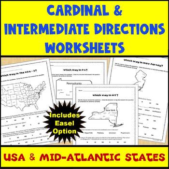
Map Skills Cardinal and Intermediate Directions Mid Atlantic States Worksheets
Do you need a way for your students to practice using maps to identify directions (both cardinal and intermediate)? If so, this set of 5 worksheets (and Easel assessment option) covering the United States and the Mid-Atlantic states of Pennsylvania, New York, and New Jersey can help. Each worksheet has 4-5 questions for students to answer using the map provided on the worksheet. There are 2 USA maps and one each for Pennsylvania, New York, and New Jersey. All of the questions are also provided
Subjects:
Grades:
2nd - 4th
Types:
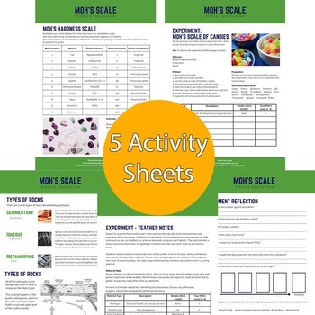
Moh's Scale of Candies
4 student activity sheets + teacher sheet in total in A4 formatBackground information on Moh's Hardness scaleA list of the experiment materials needed (uses simple materials found in local shops, at home or in the classroom)The method on how to conduct a Moh's Hardness scale experiment using candiesReflection sheet with questions that determine student understandingIncludes both an Easel Activity version of this worksheet and an Easel Assessment.Student Activity sheets for your geology & nat
Subjects:
Grades:
4th - 8th
Types:
NGSS:
MS-ESS2-3
, MS-ESS2-1
Also included in: Earth Science Teaching Bundle
Mastering Geography: Ready-to-Use Worksheet with Blank World Map for Students
Geography Awareness Lesson - No Prep *Ready-to-Use* Here is a blank Mercator Projection World Map with a built-in lesson plan ready to go out of the box to raise Geography Awareness. I use this blank map and worksheet in my lessons — especially at the start of the year.Simple Lesson Plan for "Mercator Blank World Map":Materials: Printout of Blank World Map; Worksheet (Use either as a PDF, or as a drag-and-drop Easel activity and assessment or with Google Docs)Time: 30-35 Minutes Have your stude
Subjects:
Grades:
Not Grade Specific
Types:
CCSS:
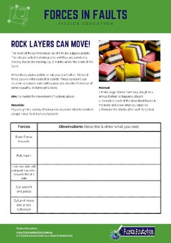
Forces in Faults Play Dough Activity
2 student activity sheets + teacher sheet in total in A4 formatBackground information on faults and the different movements of tectonic plates.A list of the experiment materials needed (uses simple materials found in local shops, at home or in the classroom)The method on how to model faults slipping using play doughReflection sheet with questions that determine student understandingIncludes both an Easel Activity version of this worksheet and an Easel Assessment.Student Activity sheets for your
Subjects:
Grades:
3rd - 6th
Types:
NGSS:
MS-ESS2-2
, 5-ESS2-1
Also included in: Earth Science Teaching Bundle
Showing 1-6 of 6 results


