TPT
Total:
$0.00

Earth/Space ActivInspire Unit III Review "Landforms, Weathering & Erosion"

;
AstronomyDad
516 Followers
Grade Levels
6th - 9th
Standards
Formats Included
  • Flipchart File
Pages
21 pages
$4.00
$4.00
Share this resource
Report this resource to TPT
AstronomyDad
516 Followers

Description

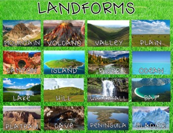
Flipchart interactive review of the unit on "Landforms, Weathering & Erosion" (Unit III). The review contains 20 questions true/false; multiple choice and text and/or numeric responses. A PDF student worksheet/study guide can also be generated by using this program.

* All PowerPoint lessons; ActivInspire programs; student note sheets/activities and assessments for this unit can be found under the "Earth/Space Complete Unit III Landforms, Weathering and Erosion " zip file folder.

Terms/concepts in the unit include:

landforms, plains, coastal plains, Great Plains, Interior plains, erosion, soils, river deposition, plateaus, Colorado Plateau, Grand Canyon, Colorado River, folded mountains, Appalachians, Sideling Hill, upwarped mountains, Adirondacks, Southern Rocky Mountains, Matterhorn, fault-block mountains, Grand Tetons, volcanic mountains, Mauna Loa, Mauna Kea, Mt. Everest, weathering, Rocky Mountains, mechanical weathering, physical weathering, ice wedging, frost wedging, pothole formation, chemical weathering, surface water, groundwater, carbonic acid, clay, oxidation, rust, climate, climate effects, marble, granite, soils, soil formation, organic soils, humus, soil profile, A, B and C soil horizons, weathering, bedrock, parent rock, litter, soil types, erosional forces, slump, slide, creep, mass movement, rock slides, avalanche, slope instability, glaciers, glacial till, glacial landforms, Great Lakes, Chesapeake Bay, Ice age, deposition, runoff, channels, rilles, gullies, rill and gully erosion, sheet erosion, stream erosion, topsoil, erosion damage, wind erosion, Dust Bowl, drainage basin, Mississippi watershed, stream development, flooding, meander, dams, levees, catastrophic floods, Scablands, delta, fan, Mississippi delta

astronomydad


Total Pages
21 pages
Answer Key
Included
Teaching Duration
30 minutes
Report this resource to TPT
Reported resources will be reviewed by our team. Report this resource to let us know if this resource violates TPT’s content guidelines.

Standards

to see state-specific standards (only available in the US).
Determine the meaning of symbols, key terms, and other domain-specific words and phrases as they are used in a specific scientific or technical context relevant to grades 6–8 texts and topics.
Integrate quantitative or technical information expressed in words in a text with a version of that information expressed visually (e.g., in a flowchart, diagram, model, graph, or table).
Compare and contrast the information gained from experiments, simulations, video, or multimedia sources with that gained from reading a text on the same topic.
By the end of grade 8, read and comprehend science/technical texts in the grades 6–8 text complexity band independently and proficiently.
NGSSMS-ESS2-2
Construct an explanation based on evidence for how geoscience processes have changed Earth’s surface at varying time and spatial scales. Emphasis is on how processes change Earth’s surface at time and spatial scales that can be large (such as slow plate motions or the uplift of large mountain ranges) or small (such as rapid landslides or microscopic geochemical reactions), and how many geoscience processes (such as earthquakes, volcanoes, and meteor impacts) usually behave gradually but are punctuated by catastrophic events. Examples of geoscience processes include surface weathering and deposition by the movements of water, ice, and wind. Emphasis is on geoscience processes that shape local geographic features, where appropriate.

Reviews

Questions & Answers

516 Followers